Northern British Columbia Traffic Cameras
Northern British Columbia Traffic Cameras
 Tupper Hwy Hwy 2, 2 km west of BC/Alberta border, looking east. Tupper Hwy Hwy 2, 2 km west of BC/Alberta border, looking east. |
|||
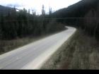 Lempriere Hwy 5, approximately 40 km north of Blue River, looking south. Lempriere Hwy 5, approximately 40 km north of Blue River, looking south. |
 Blue River Hwy 5 at Shell Rd., looking north-east. Blue River Hwy 5 at Shell Rd., looking north-east. |
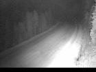 Messiter Summit Hwy 5, about 20 km south of Blue River and 19 km north of Avola, looking north. Messiter Summit Hwy 5, about 20 km south of Blue River and 19 km north of Avola, looking north. |
 Wire Cache Hwy 5, about 15 km south of Avola, looking north. Wire Cache Hwy 5, about 15 km south of Avola, looking north. |
 Masset Hwy 16 at Hodges Road in Masset on Haida Gwaii, looking north. Masset Hwy 16 at Hodges Road in Masset on Haida Gwaii, looking north. |
 Skidegate Hwy 16 at the ferry terminal on Haida Gwaii, looking north. Skidegate Hwy 16 at the ferry terminal on Haida Gwaii, looking north. |
 Port Edward Hwy 16 at Port Edward arterial road, looking west. Port Edward Hwy 16 at Port Edward arterial road, looking west. |
 Kasiks Hwy 16, at Kasiks resort area, 60 km west of Terrace, looking east. Kasiks Hwy 16, at Kasiks resort area, 60 km west of Terrace, looking east. |
 Terrace Hwy 16 at Hwy 37 near Terrace, looking east on Hwy 16. Terrace Hwy 16 at Hwy 37 near Terrace, looking east on Hwy 16. |
 Kitwanga Junction of Hwy 16 and Hwy 37, near Kitwanga, looking west on Hwy 16. Kitwanga Junction of Hwy 16 and Hwy 37, near Kitwanga, looking west on Hwy 16. |
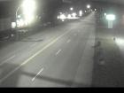 New Hazelton Hwy 16 at McLeod St in New Hazelton, looking east. New Hazelton Hwy 16 at McLeod St in New Hazelton, looking east. |
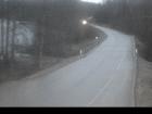 Hwy 16 at Trout Creek Hwy 16 at the Trout Creek bridge, looking east. Hwy 16 at Trout Creek Hwy 16 at the Trout Creek bridge, looking east. |
 Smithers Hwy 16 at Main Street, looking west. Smithers Hwy 16 at Main Street, looking west. |
 Hungry Hill Hwy 16 at Anderson Road, 14 km NW of Houston, looking east. Hungry Hill Hwy 16 at Anderson Road, 14 km NW of Houston, looking east. |
 Six Mile Hill On Hwy 16, 40 km west of Burns Lake looking west. Six Mile Hill On Hwy 16, 40 km west of Burns Lake looking west. |
 Hwy 16 at Augier Rd Hwy 16 at Augier Rd, about 22 km east of Burns Lake, looking west. Hwy 16 at Augier Rd Hwy 16 at Augier Rd, about 22 km east of Burns Lake, looking west. |
 Priestly Hill Hwy 16, about 32 km east of Burns Lake, looking east. Priestly Hill Hwy 16, about 32 km east of Burns Lake, looking east. |
 Savory Rest Area Hwy 16, 48 km east of Burns Lake, looking west. Savory Rest Area Hwy 16, 48 km east of Burns Lake, looking west. |
 Bednesti Hwy 16 at Bednesti between Prince George and Vanderhoof, looking west. Bednesti Hwy 16 at Bednesti between Prince George and Vanderhoof, looking west. |
 Peden Hill-Prince George 1 Hwy 16 at Davis Rd in Prince George, looking eastbound. Peden Hill-Prince George 1 Hwy 16 at Davis Rd in Prince George, looking eastbound. |
 Peden Hill-Prince George 2 Hwy 16 at Vance Rd in Prince George, looking westbound. Peden Hill-Prince George 2 Hwy 16 at Vance Rd in Prince George, looking westbound. |
 Bowron River Hwy 16, about 54 km east of Prince George near Purden Lake, looking west. Bowron River Hwy 16, about 54 km east of Prince George near Purden Lake, looking west. |
 Dunster Station Rd Hwy 16 at Dunster Station Rd, about 30 km east of McBride, looking east. Dunster Station Rd Hwy 16 at Dunster Station Rd, about 30 km east of McBride, looking east. |
 Tete Jaune Cache Hwy 16 at Hwy 5 junction, looking east. Tete Jaune Cache Hwy 16 at Hwy 5 junction, looking east. |
 Red Pass Hwy 16, 27 km east of Tete-Jaune Junction, 40 km west of BC/Alberta border. Red Pass Hwy 16, 27 km east of Tete-Jaune Junction, 40 km west of BC/Alberta border. |
 Fort St. James Hwy 27, about 32 km south of Fort St. James, looking north. Fort St. James Hwy 27, about 32 km south of Fort St. James, looking north. |
|||
 Peace View Rest Area Hwy 29, 29 km west of Ft. St. John, looking southwest. Peace View Rest Area Hwy 29, 29 km west of Ft. St. John, looking southwest. |
 Tumbler Ridge Hwy 29 at Hwy 52, looking west on Hwy 29. Tumbler Ridge Hwy 29 at Hwy 52, looking west on Hwy 29. |
||
 Francois Lake Ferry Landing Hwy 35 at Southbank ferry landing on Francois Lake. Francois Lake Ferry Landing Hwy 35 at Southbank ferry landing on Francois Lake. |
|||
 BC-Yukon Border Hwy 37 at BC-Yukon Border |
 Good Hope Lake Hwy 37 near Good Hope Lake, looking north. |
Image Temporarily Unavailable. Dease Lake Junction of Hwy 37 and Commercial Drive in Dease Lake, looking north on Hwy 37. |
 Meziadin Junction Hwy 37 and Hwy 37A at Meziadin Junction, looking north. |
 Kitimat Hwy 37 at Oolichan Avenue, 5 km north of Kitimat, looking North |
 Onion Lake West side of Hwy 37S at Onion Lake Cross Country ski trails. |
||
 Stewart Hwy 37a between Stewart,BC and Hyder, USA, looking north. Stewart Hwy 37a between Stewart,BC and Hyder, USA, looking north. |
| Image Temporarily Unavailable. Liard Hwy Junction Hwy 97 – Hwy 77 junction, on Hwy 97 about 28 km north of Ft. Nelson, looking east. |
 Steamboat Hill Hwy 97, about 80 km north-west of Ft Nelson, looking west. |
 Fort Nelson Hwy 97 at Fort Nelson weigh scale, looking north. |
 Mile 73 Hwy 97 at Beaton Highway, 44 km north of Fort St. John, looking north. |
 John Hart Hwy Hwy 97 (John Hart Hwy) at Mason-Semple Rd, looking east. |
 Dawson Creek – N Hwy 97 at Dangerous Goods Route, west of Dawson Creek, looking north. |
 Dawson Creek – W Hwy 97 at Dangerous Goods Route, west of Dawson Creek, looking west. |
 Dawson Creek – E Hwy 97 at Dangerous Goods Route, west of Dawson Creek, looking east. |
 Dawson Creek – S Hwy 97 at Dangerous Goods Route, west of Dawson Creek, looking south. |
 South Taylor Hill Hwy 97 at South Taylor Hill, 20 km south of Fort St John, looking north. |
 East Pine Hill Hwy 97 on East Pine Hill, about 27 km east of Chetwynd, looking east. |
 Chetwynd Hwy 97 at Wabi Estates Road, east of Chetwynd, looking east. |
 Pine Pass Hwy 97, north of Mackenzie Junction at Powder King access road, looking north. |
 Mackenzie Junction Hwy 97 at Hwy 39, about 29 km south of Mackenzie looking east. |
 Summit Lake Hwy 97 at Summit Lake Rd, about 33 km north of Prince George, looking north. |
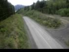 Grizzly Hill Hwy 113 (Nass Rd) about 3 km southwest of Village of Laxgalts’ap (Greenville), looking west. Grizzly Hill Hwy 113 (Nass Rd) about 3 km southwest of Village of Laxgalts’ap (Greenville), looking west. |
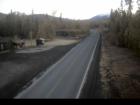 Rosswood Hwy 113 near Rosswood, about 44 km north of Terrace, looking north. Rosswood Hwy 113 near Rosswood, about 44 km north of Terrace, looking north. |
 Laxgalts’ap (Greenville) Hwy 113, near Village of Laxgalts’ap (Greenville) in the Nass Valley, looking eastbound. Laxgalts’ap (Greenville) Hwy 113, near Village of Laxgalts’ap (Greenville) in the Nass Valley, looking eastbound. |
 Gitwinksihlkw Hwy 113 at Anlaw Rd, near Gitwinksihlkw, within Nisga’a Memorial Lava Bed Provincial Park, looking east. Gitwinksihlkw Hwy 113 at Anlaw Rd, near Gitwinksihlkw, within Nisga’a Memorial Lava Bed Provincial Park, looking east. |
